Interactive 3D models and films for exploration and mining companies
Show investors what is under the ground.
I build 3D models and short films of exploration projects from your own drill database, terrain and maps. Each model opens in any web browser, with nothing to install.
Recent work
Gold project in Canada, for a listed exploration company
October 2026
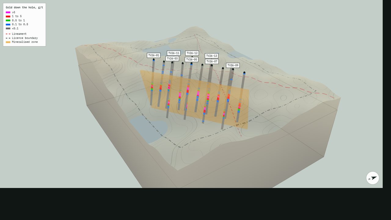
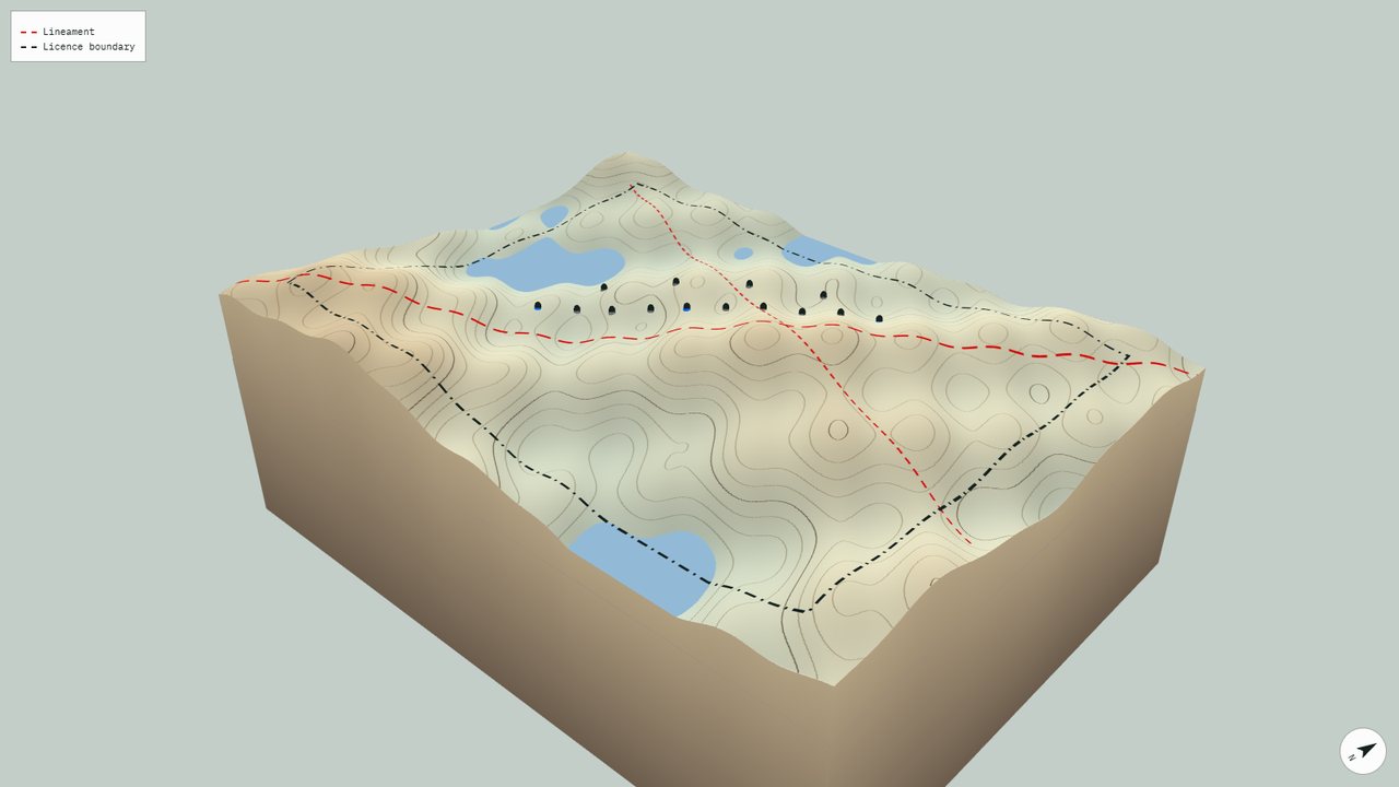
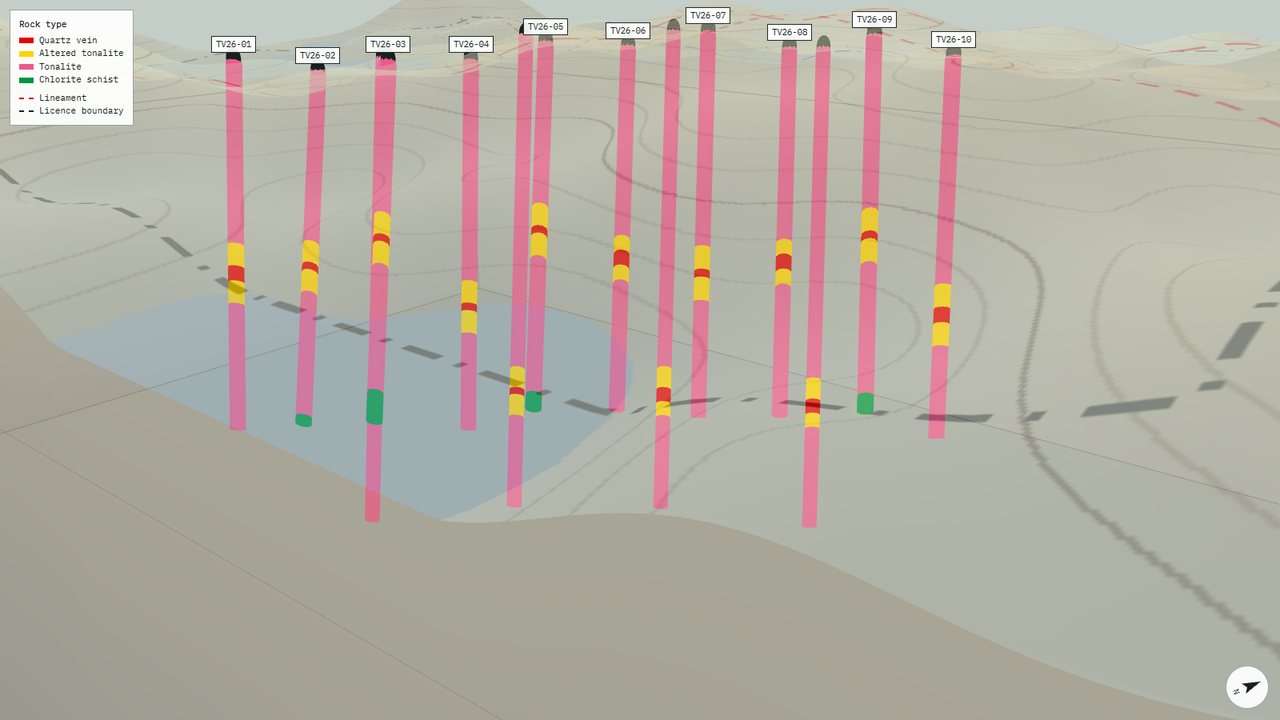
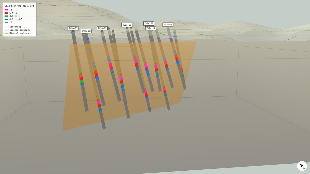
Seven interactive models and a 66 second film, built from LiDAR terrain, satellite images, sampling and the full drill database. Every symbol and colour follows the company's own map legend. The views below come from the demonstration model at the top of this page.
Services
What you receive
Interactive 3D model
One web file that opens in any browser and can go into an email, a data room or your website. Terrain from LiDAR, satellite images or your geological map, with drill holes, samples and structures in place.
3D film
A flight over the property with short text captions and music, for your website, a conference screen or social media. Your own voice-over can be added later.
Data check before modelling
Collars, surveys, assays and logs are checked against each other. Every problem is listed with the row it comes from, so nothing appears in the model that is not in your tables.
Maps and sections
Plans and long sections in your house style, matched to the 3D model, for news releases and presentations.
Inside every model
Built for geologists, readable for investors
- GoldGrade classes down every hole, with the value of each interval on hover.
- RockRock type intervals grouped from your own logging codes.
- TerrainSee-through surface, so drilling stays visible from any angle.
- ScaleVertical exaggeration control, north arrow and a live scale bar.
- LegendYour 2D map legend, symbol for symbol and colour for colour.
- LabelsHole names that appear as you zoom in, without clutter.
- ZoomZoom goes to the point under the cursor, not the centre of the block.
- OfflineNo server and no software. The file works without internet.
Process
From your tables to a finished model
- Step 1
You send the data
Drill tables, terrain, maps and the legend you already use.
- Step 2
Data check
A short report of every inconsistency, before modelling starts.
- Step 3
One model to review
You correct colours, labels and views on a single model first.
- Step 4
Final files
All agreed models, the film and a note of the checks made.
About
Tijana Vukelić
Exploration geologist and GIS specialist working on gold projects in East Africa and Canada. I build 3D geological models in Leapfrog Geo and prepare maps, sections and data checks for technical teams and investors.
Every number in a model is checked twice against the source tables before delivery.
Contact
Send a short description of your project
Tell me where the project is and what data you have. You will receive a reply within one working day, with a proposed set of views and a fixed price.